 TRANSDAT (English)
Rating
 Downloads
: 250
|
Price : 200.00
Shareware
Size :
3.45MB |
|
|
Version : 14.03 |
Major Update
|
| OS
Win2000 , Win7 x32 , Win7 x64 , Win98 , WinMobile , WinOther , WinServer , WinVista , WinVista x64 , WinXP
|
|

TRANSDAT - Coordinate conversion
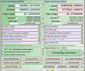
TRANSDAT Geosoftware executes coordinate transformations and geodetic datum shifts between many coordinate and reference systems of America, Australasia, Europe, Germany special and world-wide, at high precision and high speed: 1 . The current and historical coordinate and reference systems of all countries of the European Union (EU) including the eastern extensions and the systems of non-EU countries. 2. The INSPIRE supported European ETRS89 systems. 3. The US and Canadian State Plane Coordinate Systems (SPCS) on NAD27 and NAD83 and other coordinate systems of the North American continent. 4. The coordinate and reference systems of the Australasian continent. 5. Many coordinate and reference systems of the countries of other continents. 6. World-wide NTv2 grid file supported coordinate transformations. 7. All world-wide coordinate and reference systems in current use. 8. The German coordinate and reference systems of the old and new federal states, the 40 Prussian Soldner Land Registers, the German Lagestatus, and exact reference systems of the German federal states. You will find a complete list of the coordinate and reference systems supported by the program on the internet or after downloading the free test version of the program. The NTv2 standard with national grid files is world-wide full supported. Apart from the given world-wide and state-specific systems, your own personal coordinate systems and geodetic reference systems can be defined with Helmert (Bursa / Wolf, ISO19111) or Molodenski parameters. Calculations can be carried out with coordinates joined directly, loaded from documents in various formats (Text, CSV, SDF, dBase, ArcShape and ArcGenerate), or passed via batch processing. ArcShape documents can be seen with the program-internal Shape Viewer. A programmable GPS interface makes it possible to read heads right into a notebook computer from a low-cost GPS antenna. The program can become run on a network, in which case clients are installed automatically.
|
Requirements :
500 MHz, 500 MB Memory, 100 MB HD
|
|
|
|
Questions or Problems with This Program ! |
Report Bad Link |
|
If you have any questions please post it and we will answer it asap .
[ Comments allowed for anonymous users, please dont register ]
|
So far so good :
No Comments :: No Problems :: No Answers
|
| |
Other software for same Developer :
|
Please Scan for Viruses before use .

 Downloads
: 250


