1 .
PCLTool SDK
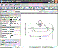
| PCLTool SDK is a collection of tools for converting PCL text, raster and vector files into bitmap formats (PCL to TIF, in-memory DIB, PCX, DCX, BMP, XPS and PNG) or vector formats (PCL to in-memory GDI, | |
Rating
 2
2 |
Downloads : 1062 |
 Rate This Program |
 Report error
 |
|
| Hits | 1062 |
| Version | 9.05 |
| Date | 16/08/2010 |
| License | Demo |
| PCL Tool SDK 32-bit is a collection of tools for converting PCL text, raster and vector files into bitmap formats (PCL to in-memory DIB, TIF, JPG and PNG) or vector formats (PCL to in-memory GDI, EMF | |
Rating

|
Downloads : 402 |
 Rate This Program |
 Report error
 |
|
| Hits | 402 |
| Version | 12.0 |
| Date | 13/03/2012 |
| License | Demo |
3 .
LiteCAD SDK
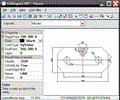
| LiteCAD SDK is a tool for software developers who build own specialized drawing applications, CAD/CAM/GIS type. The main component of the package, LiteCAD DLL provides 2D vector graphics possiblilities | |
Rating

|
Downloads : 347 |
 Rate This Program |
 Report error
 |
|
| Hits | 347 |
| Version | 2.0.0.48 |
| Date | 12/06/2011 |
| License | Shareware |
| JOpt.SDK is a route optimization and planning Java library for automatic resource scheduling and transportation planning. It uses specialized genetic algorithms to calculate an optimized allocation of | |
Rating

|
Downloads : 346 |
 Rate This Program |
 Report error
 |
|
| Hits | 346 |
| Version | 2.3.8 |
| Date | 07/06/2010 |
| License | Demo |
| CAD Import .NET is a library for smart CAD development in Microsoft Visual Studio. It contains managed code only and displays drawings with GDI+ methods; supports DWG, DXF, HPGL, CGM, GBR, raster and | |
Rating

|
Downloads : 331 |
 Rate This Program |
 Report error
 |
|
| Hits | 331 |
| Version | 7.2 |
| Date | 26/08/2009 |
| License | Shareware |
| CAD Import .NET is a library for reading AutoCAD DWG/DXF, PLT and CGM in C#, VB.NET and other .NET applications. DWG 2007/2008 is supported. Library reads BMP, JPG, Tiff, GIF, ICO and saves to DXF. | |
Rating
 3
3 |
Downloads : 296 |
 Rate This Program |
 Report error
 |
|
| Hits | 296 |
| Version | 6 |
| Date | 24/07/2014 09:43:00 |
| License | Shareware |
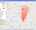
| Map Suite Desktop is a GIS component that enables .NET developers to add interactive maps to their Windows desktop applications. Designed as an easy-to-learn yet powerful .NET native component, Map Suite | |
Rating

|
Downloads : 281 |
 Rate This Program |
 Report error
 |
|
| Hits | 281 |
| Version | 2.55.0 |
| Date | 30/06/2008 |
| License | Demo |
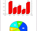
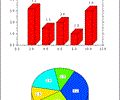
| DISLIN is a high-level and easy to use plotting library for displaying data as curves, bar graphs, pie charts, 3D-colour plots, surfaces, contours and maps. Several output formats are supported such as | |
Rating

|
Downloads : 264 |
 Rate This Program |
 Report error
 |
|
| Hits | 264 |
| Version | 10.0 |
| Date | 15/01/2010 |
| License | Freeware |
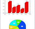
| DISLIN is a high-level and easy to use plotting library for displaying data as curves, bar graphs, pie charts, 3D-colour plots, surfaces, contours and maps. Several output formats are supported such as | |
Rating

|
Downloads : 261 |
 Rate This Program |
 Report error
 |
|
| Hits | 261 |
| Version | 10.0 |
| Date | 15/01/2010 |
| License | Freeware |
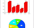
| DISLIN is a high-level and easy to use plotting library for displaying data as curves, bar graphs, pie charts, 3D-colour plots, surfaces, contours and maps. Several output formats are supported such as | |
Rating

|
Downloads : 253 |
 Rate This Program |
 Report error
 |
|
| Hits | 253 |
| Version | 10.0 |
| Date | 15/01/2010 |
| License | Freeware |
| DISLIN is a high-level and easy to use plotting library for displaying data as curves, bar graphs, pie charts, 3D-colour plots, surfaces, contours and maps. Several output formats are supported such as | |
Rating

|
Downloads : 248 |
 Rate This Program |
 Report error
 |
|
| Hits | 248 |
| Version | 10.0 |
| Date | 15/01/2010 |
| License | Freeware |
| SQLitePlus is a powerful database explorer program and a COM wrapper DLL for the well-known SQLite C database engine (www.sqlite.org). The SQLitePlus Admin tool allows you to open and view multiple databases | |
Rating

|
Downloads : 248 |
 Rate This Program |
 Report error
 |
|
| Hits | 248 |
| Version | 3.0.8 |
| Date | 07/07/2007 |
| License | Commercial |

